©
Jenny Norlin - UN

©
Holm - CEU

©
CEU

©
CEU


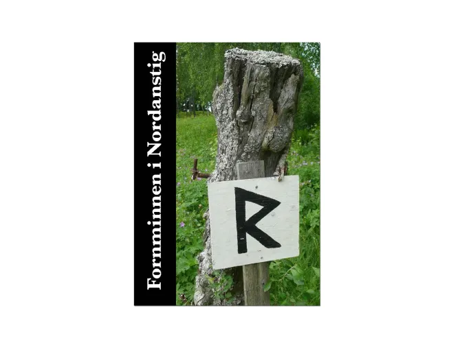
Did you know that Nordanstig is one of Norrland's most historic areas?! Nordanstig has over 2,000 ancient monuments registered in the Swedish National Antiquities Authority's register.
There is a nice brochure with a selection of these ancient monuments, which you can easily download through our website (Although, only available in Swedish.)
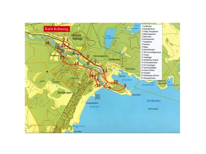
Nordanstig is very rich in cultural monuments. The land elevation after the last ice age has been very strong and is between 240 and 255 m. Large parts of the municipality were thus under water.
After the ice receded, present-day Bergsjö was a sparse archipelago. Only Bålleberget and a few other heights stuck out of the sea like islands. After that, the uplift of the land created a landscape with deep sea inlets that went far inland where Gnarp and Harmånger are now located.
The first settlements thus took place inland of the municipality and were then expanded to the deep sea bays. The finds of chernozem, which are found in several places in the municipality, show this.
During the 200s to 400s, settlement increases along the middle coast of Norrland. On the south side of Lake Bälingsjön in Jättendal, there are examples of nine unique house premises that may have been 15 – 20 courtyards. Our region then consisted of several so-called small kingdoms, countries that had contacts with each other and with the continent.
The folklands of Nordanstigen in Nordanstig, Sunded in Hudiksvall and Alir in Söderhamn developed during this time. These countries had ruling royal families. The king gave military protection to his subjects. More efficient farming methods, and the transport of nutrients through the harvesting of forage along wetlands provided the grain fields around the farms with plenty of manure. That nutrient supply provided the harvest surplus that was the prerequisite for the growth of the small kingdoms. Many farms were hastily abandoned during the 5th to 7th centuries. The reason for that is still unknown. Recovery of the agricultural area only takes place during the late Viking Age.

Selected filters: